 Capture Platform · ering-cad.com/cama-edition.html
Capture CAMA Edition
AI-infused CAMA, built on Capture technology.
Map. Value. Assess. Collect.
Streamline data entry and eliminate redundant effort through workflow re-engineering, artificial intelligence and automation.
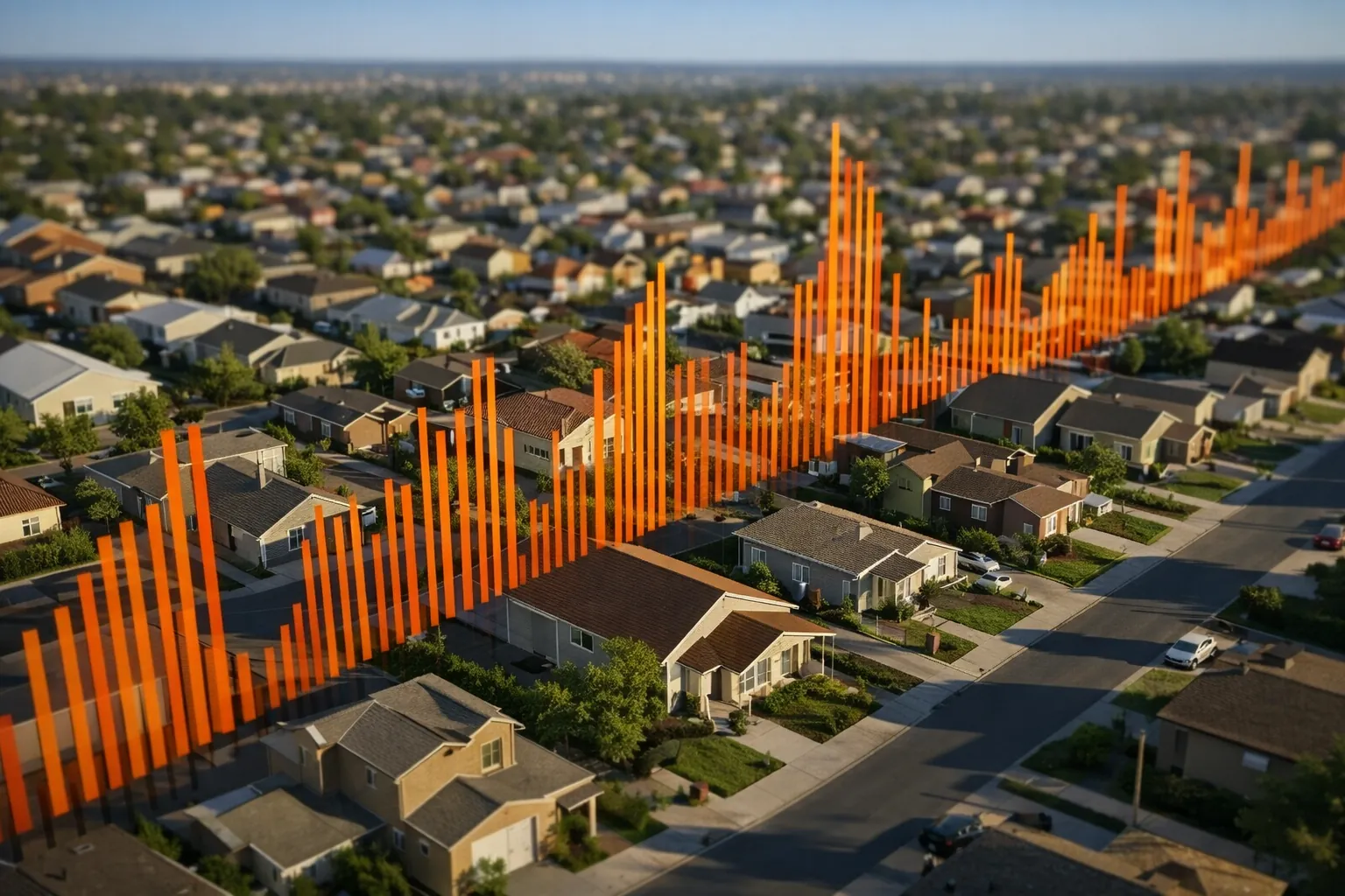
Capture is a web-based system that harnesses AI and integrates with mapping, deeds, permits and more. As one comprehensive database, it manages multiple record years, handles deed processing, generates tax rolls and facilitates supplements, escapes and petitions. Assessment, collection, GIS and public-facing tools work together as a true “soup to nuts” solution for property tax administration.
How it works
One system, from deed to settlement.
Deeds in
Capture pulls deeds from your recording system every day. AI resolves parcel numbers and routes them for name change and sales verification.
Map and value
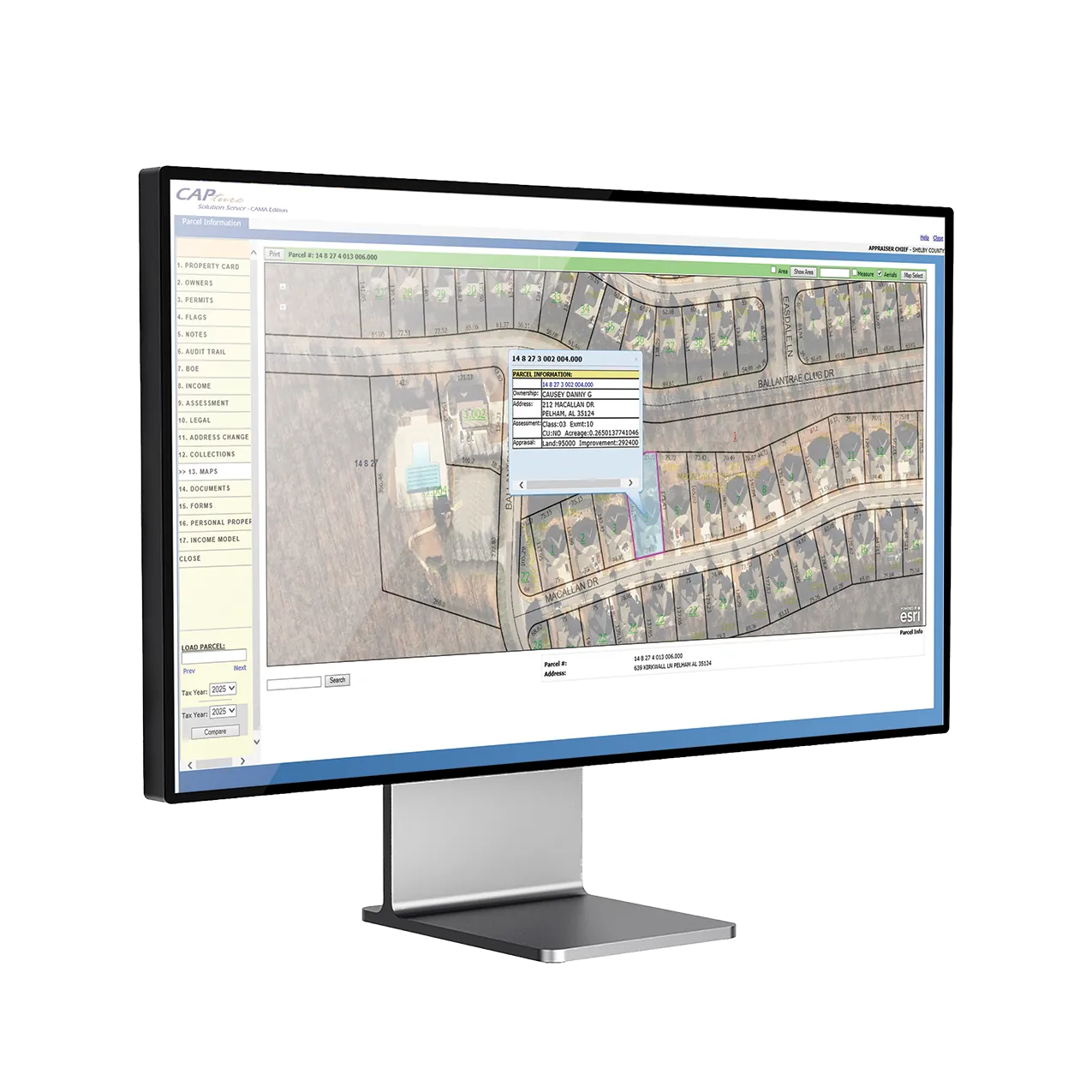
A two-way Esri link with Arc desktop, ArcGIS Online and Arc for iOS, plus cost, market and income approaches with mass updates and real-time what-if.
Assess and appeal
Exemptions from homestead to caps and limits, business personal property rolls, and appeal hearings scheduled from one dashboard.
Bill and collect
QR-coded bills, every payment type including ACH and Check 21, bank reconciliation and year-end settlement in Billings & Collections.
AI technology
The latest AI, built into Capture CAMA.
AI Deed Processing
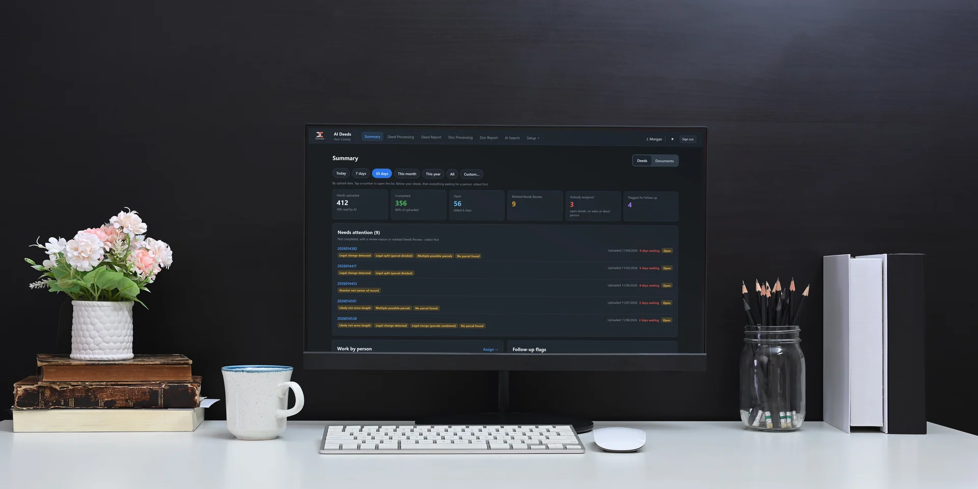
Intelligent Document Processing reads legal documents, from messy handwriting to complex legal descriptions, and pulls names and parcel IDs into the tax system so staff focus on exceptions.
Learn more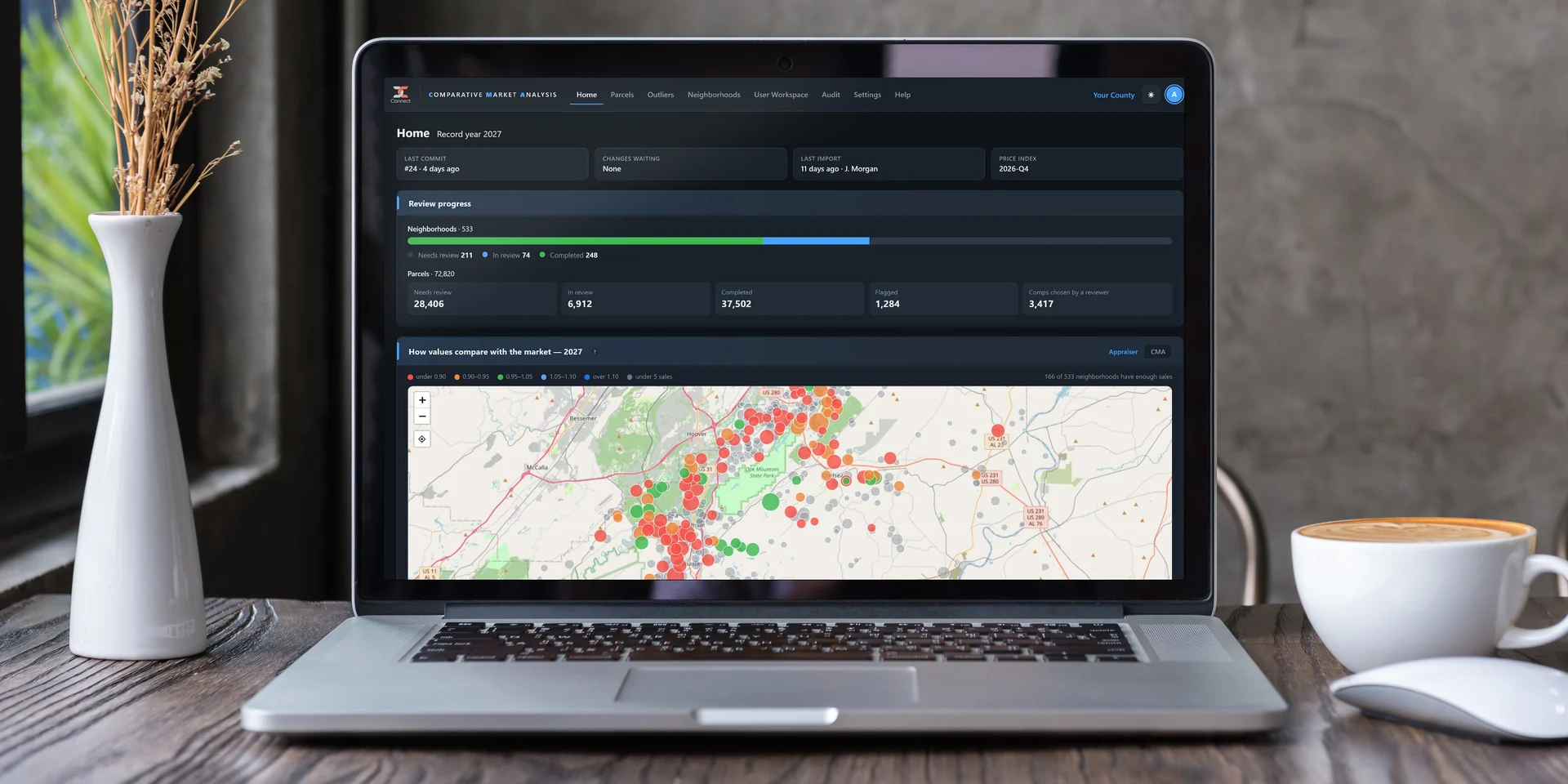
AI Data Quality Control
Machine learning analyzes market trends and property characteristics, selects the best comparable sales and helps identify valuation outliers before tax bills are sent.
Learn more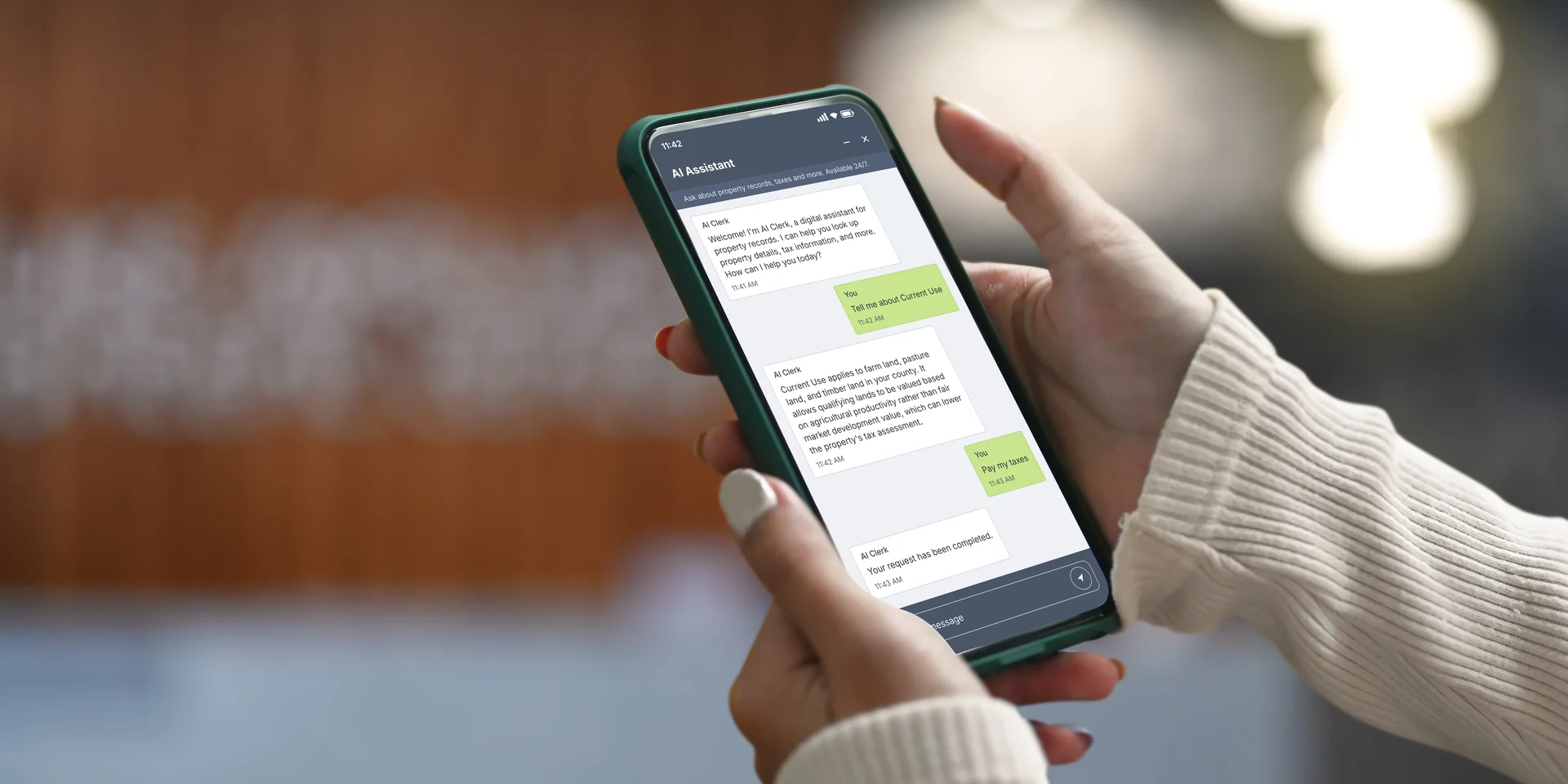
AI Digital Clerk
A complete citizen service platform: 24/7 AI answers in chat and email, live staff handoff, ticket tracking and a dashboard that shows the impact.
Learn moreBuilt for the way offices work now
Dashboards and field tools that keep pace.
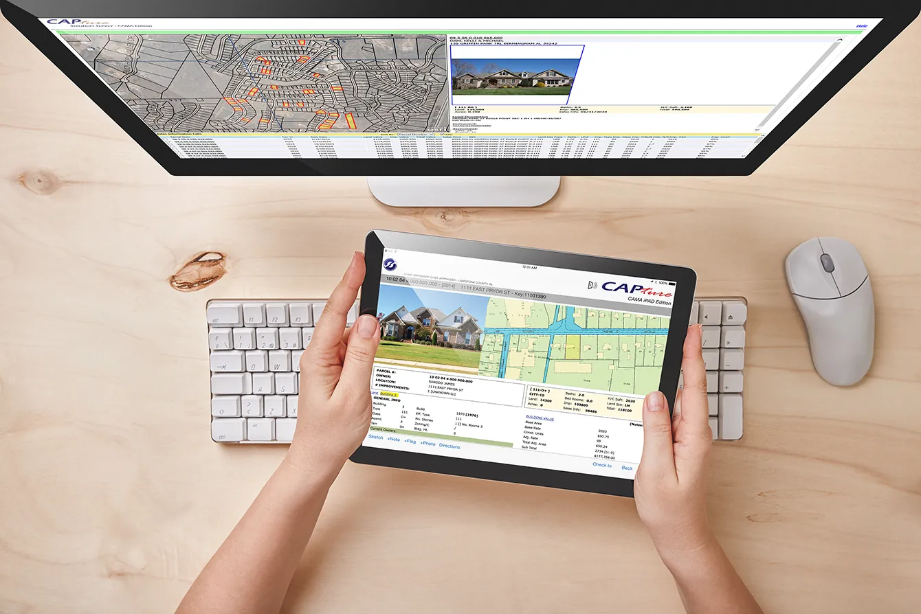
Supervisors predict workloads and completion times, and field appraisers finish their work on site, with or without a connection.
- Workload dashboards
- Response and completion estimates
- Capture iPad
- Works offline
- Sketches and photos
- Maps and attributes
- No duplicate entry
- Digital signature pads
- One-click Excel export
Streamlining the assessment process
Feature highlights.
Everything an assessment office needs, in one web-based platform.
Valuation & analysis
Three approaches to value
Cost, income and sales comparison models. Store multiple values on a parcel and reconcile the final value at the parcel level.
Sales ratio studies and a what-if sandbox
Group sales by neighborhood, test assessment accuracy and model new values without touching the live roll.
Cost tables and mass maintenance
Marshall & Swift or built-in cost tables. Change characteristics, ownership or documents on many accounts at once.
Assessment & appeals
Assessment automation
Exemption processing, notices and letters generated straight from the property record.
Appeals case management
Petitions, evidence, hearing schedules and decisions tracked end to end, with hearing-ready comp grids.
Business personal property
Returns, renditions, estimates, penalties and depreciation schedules in one workflow.
Field & GIS
Offline iPad field appraisal
Parcel data, sketching, photos and maps work without a connection, then sync when you are back online.
Web-based sketching
Sketch in the browser, tied directly to the cost model. Compatible with Apex Sketch.
GIS and imagery in the record
Esri ArcGIS, EagleView and Google Street View open from the property record, including side-by-side aerial comparison.
Platform & security
Complete audit trail
Who made each change, when, the prior and new values, and why. Field-level, role-based security.
Secure, single-tenant hosting
Off-site disaster recovery, single sign-on, and data centers with SOC 1 and SOC 2 Type II audited controls.
Reports, workflows and APIs
Customizable report templates, configurable rules-based workflows and REST APIs.
AI with a human in the loop. Appraisers approve every AI suggestion, and your data is never used to train models for anyone else. AI Products
Public self-service. Online appeals, exemptions, personal property filings and tax payments. Capture Connect
Support from the people who built it. E-Ring's own staff provide support and training, never a subcontractor. Support
One platform, your way
From deed to settlement.
Capture covers the entire property tax cycle. Run it as one system, or only the part your office needs.
Complete package
One system, one shared database.
Assessment and collections run on the same Capture database. Ownership, value and exemption changes flow straight into bills, there are no interfaces between offices to maintain, and one audit trail follows each parcel from deed to receipt.
Separate installations
Assessment or collections on its own.
Keep the system another vendor already runs in one office, or let each department choose for itself. Capture is installed as the assessment system or the collection system, and the data exchange with the other office’s system is customized as part of the solution.
Our journey
From CAMA pioneer to AI innovator.
Designed to streamline the entire assessment process, from deed processing and tax roll generation to appeals and taxpayer correspondence.
- 1999
E-Ring was founded by former Intergraph CAD engineers.
- 2004
E-Ring introduced web-based CAMA technology to the local government sector.
- 2009
E-Ring implemented a true bi-directional GIS/CAMA integration with Esri products.
- 2011
Capture’s mobile iPad solution let appraisers perform fieldwork with or without internet connectivity.
- 2014
E-Ring began hosting CAMA solutions on its own cloud network.
- 2019
E-Ring integrated payment processing on the Capture platform.
- 2023
Capture Connect was born: E-Ring’s public-facing solution built on Capture technology.
- 2025
E-Ring introduced AI-infused CAMA to the industry, with AI for deed processing, public support and data quality control.
Product brochure
Take the Capture CAMA brochure with you.
Schedule a demo
See it in real time.
Book a live demo and a sales representative will walk you through Capture CAMA and how it fits your office.
See it in real time.
Schedule a live demo of Capture CAMA.
sales@ering-cad.com · +1 (678) 240-2750 · ering-cad.com
E-Ring, Inc. · 3015 Windward Plaza, Suite 575, Alpharetta, GA 30005
Printed from ering-cad.com. Scan the code for the latest version.